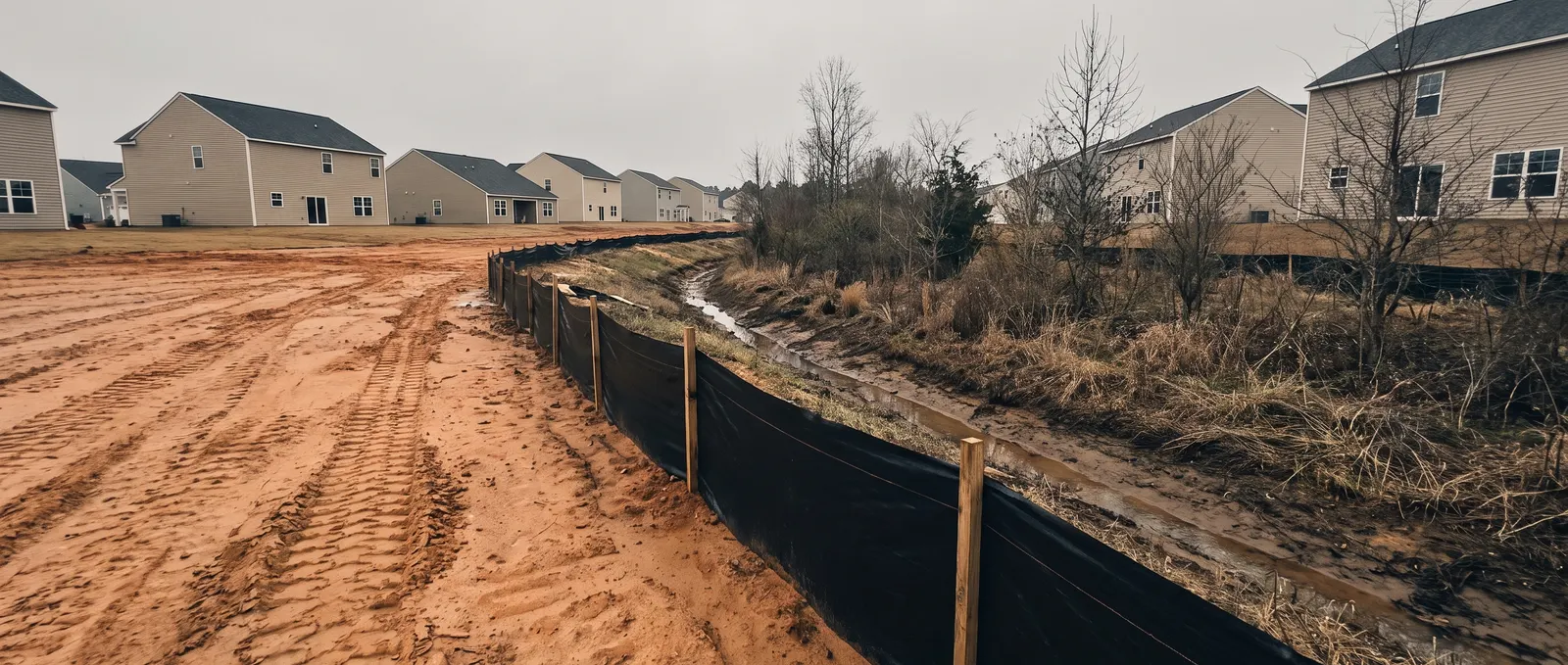
Two things Johnston County homeowners ask first
When does Johnston County require an erosion control permit?
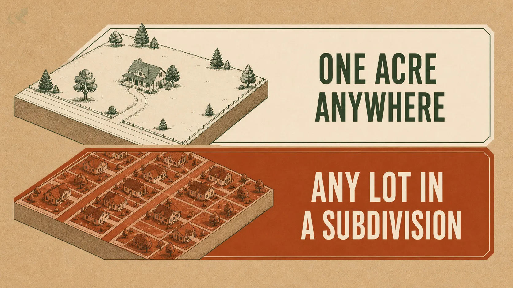
At one acre of land disturbance — the statewide default — or below an acre if your lot is part of a subdivision or larger common plan of development. That second clause is the one that catches people: in a newer Johnston subdivision, the acreage question may not be the deciding one. Applications go to Johnston County Public Utilities, not Planning or Inspections.
Why is there a protected buffer along the ditch behind my house?
Because Johnston sits in the Neuse River Basin, which carries mandatory riparian buffer protection. The part that surprises homeowners: the rules apply to intermittent streams and most modified natural streams — not just year-round creeks. A channel that only runs after heavy rain can still carry a protected buffer, and that buffer can sit exactly where you wanted to put a drainage fix.
Most counties in this directory earn their page on a threshold — a number that differs from the state default and catches people out.
Johnston doesn’t. Its land-disturbance trigger is one acre, the same as the statewide rule, and its subdivision clause matches Wake’s next door. On paper, nothing unusual.
The unusual thing is where the water goes.
Johnston lies in the Neuse River Basin, which North Carolina manages as nutrient-sensitive water. That brings mandatory riparian buffer protection — and unlike the drinking-water watershed rules that shape the Triad, this regime exists to limit what reaches the estuary downstream. Different purpose, different trigger, and one detail that catches homeowners repeatedly:
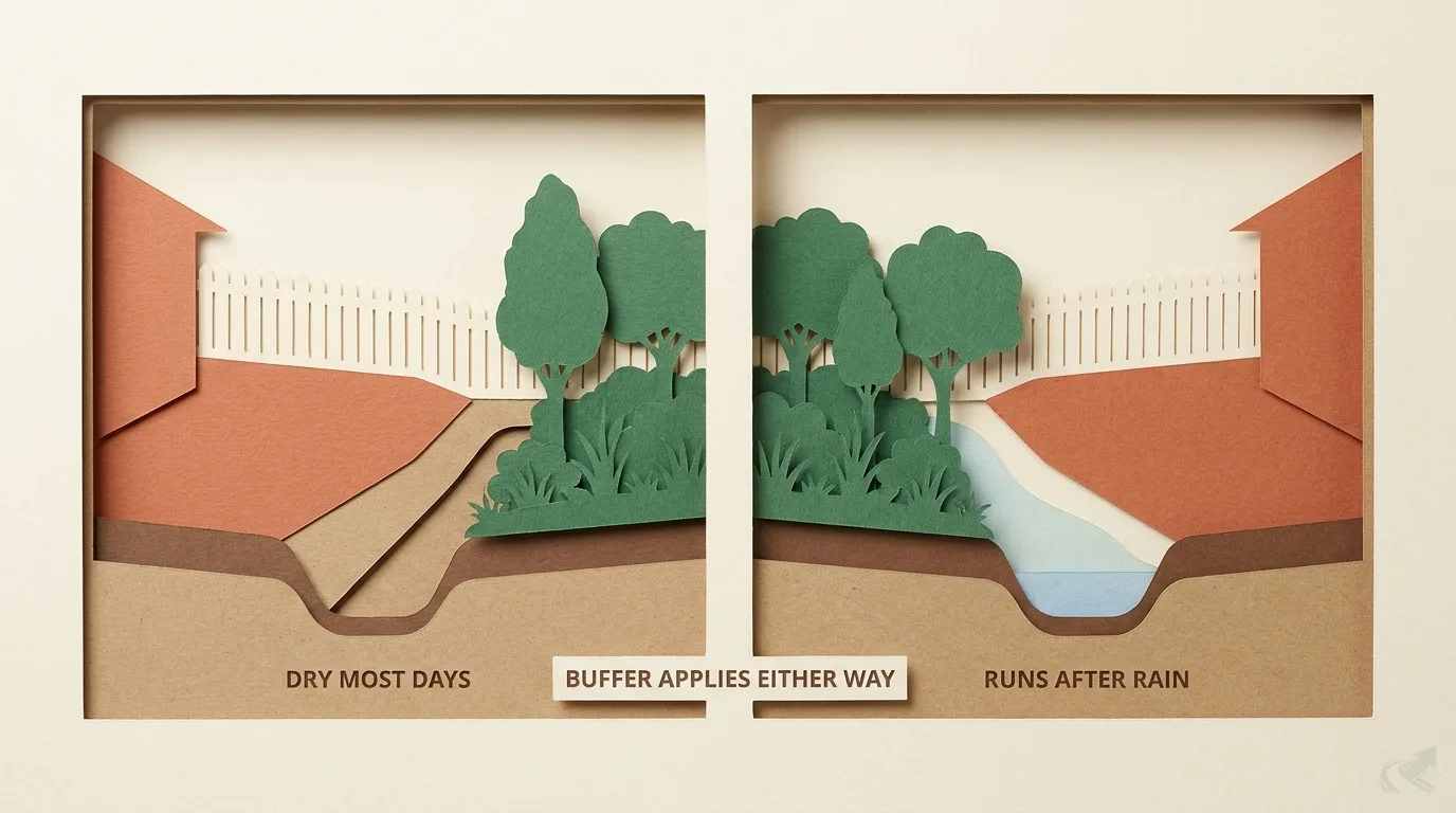
The buffer rules apply to intermittent streams.
Not just the creek at the back of the neighbourhood. The channel that only runs after heavy rain counts too. So does most modified natural stream. Which means the low, wet corner you were planning to regrade may sit inside a protected buffer — and the fix you had in mind may be the one thing you can’t do there.
This page covers the permit triggers, who administers them, and what the buffer actually restricts.
Do you need a permit? Two triggers
One acre, or any lot inside a subdivision.
| What requires an erosion control permit in Johnston County | The trigger | What to know |
|---|---|---|
| One acre or more of disturbance | The statewide default trigger | Same as the NC Sedimentation Pollution Control Act baseline |
| Part of a subdivision or common plan | Applies below an acre | Multiple lots in one subdivision are submitted on a single consolidated application, not one permit per lot |
| Work inside a riparian buffer | A separate question from acreage entirely | Governed by the Neuse basin buffer rules — see below |
One acre or more of disturbance
- The trigger
- The statewide default trigger
- What to know
- Same as the NC Sedimentation Pollution Control Act baseline
Part of a subdivision or common plan
- The trigger
- Applies below an acre
- What to know
- Multiple lots in one subdivision are submitted on a single consolidated application, not one permit per lot
Work inside a riparian buffer
- The trigger
- A separate question from acreage entirely
- What to know
- Governed by the Neuse basin buffer rules — see below
Two practical notes that save phone calls:
The office is Public Utilities. Johnston County administers erosion and sediment control through Public Utilities, not Planning or Inspections. Most counties in this directory do it the other way round, so this is a common wrong-number.
Stabilisation is on a clock. Permanent ground cover sufficient to restrain erosion within 90 calendar days of completion, and exposed slopes planted or otherwise protected within 14 calendar days of finishing any grading phase.
The Neuse buffer: what actually restricts you
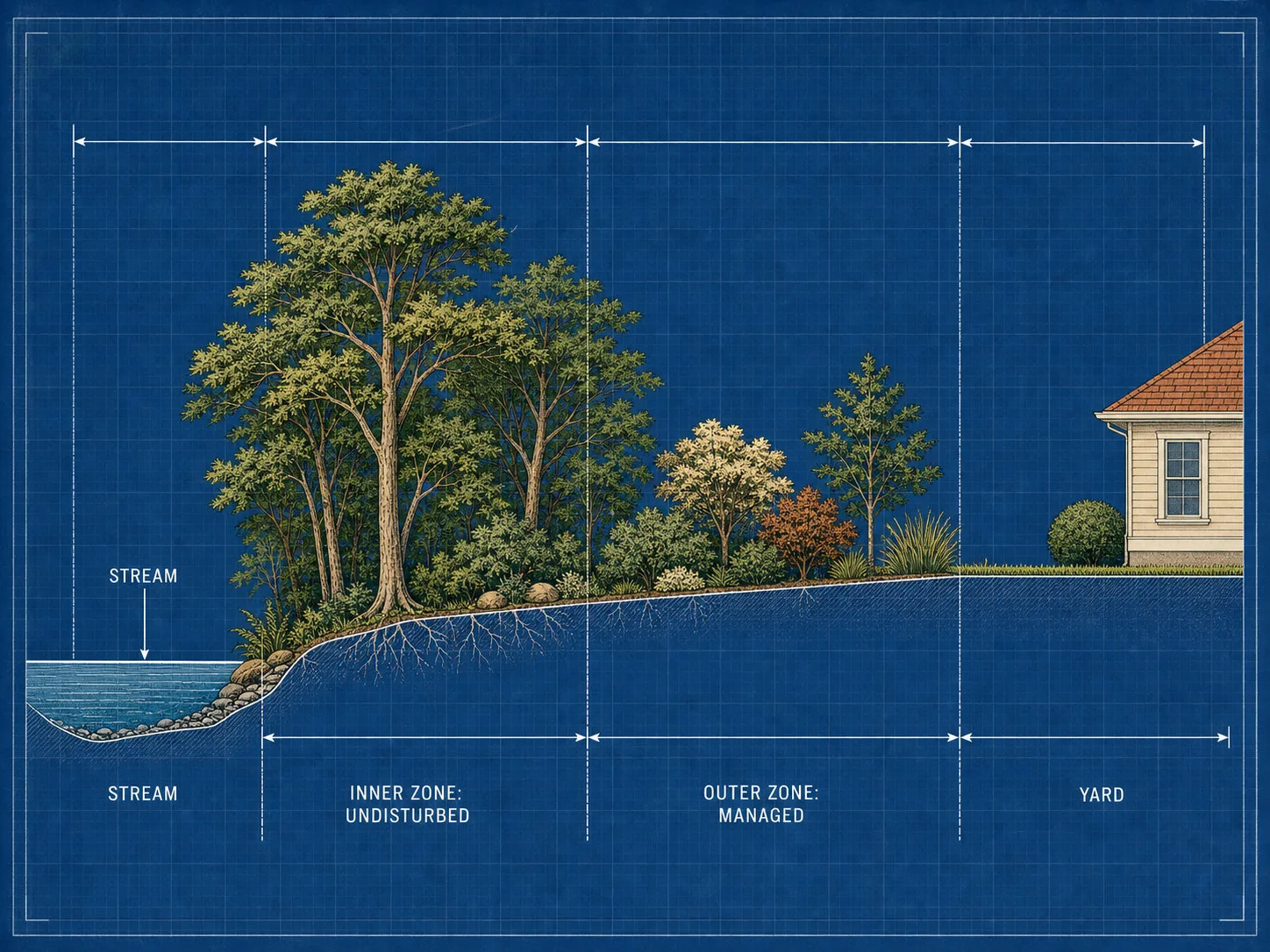
Two zones, measured from the water — and the water counts more broadly than people expect.
A along a protected watercourse in Johnston County is managed in two zones: an inner zone nearest the water that stays essentially undisturbed, and an outer zone behind it where vegetation is managed and certain uses are allowed.
The rule is a state one — 15A NCAC 02B .0233, the Neuse River Basin nutrient-sensitive waters rule — codified locally in the Johnston County Code at Sec. 14-393, applying to all land in the county’s planning jurisdiction inside the Neuse watershed.
What counts as protected water is the part to check first. Per Johnston County’s own guidance, the buffer rules apply to intermittent streams and most modified natural streams, alongside perennial streams and water bodies. A drainage feature that carries water only after rain is not automatically outside the rule.
Why this matters for a drainage project. The instinct when a back corner holds water is to move the water — regrade toward the low point, cut a swale, run a line to daylight. If that low point is a protected watercourse, the work you were planning may sit in the zone that has to stay undisturbed. Establishing where the buffer starts is the first question on a Johnston lot, not the last.
Zone widths, the table of allowable uses, and how the buffer is measured are set by the rule itself — confirm them with Johnston County Public Utilities or NC DEQ before planning work near any watercourse. Do not take a width from a contractor’s memory.
Every Johnston County resource you’ll need
If your yard holds water, start with standing water in your yard — diagnose the cause before pricing a fix, and establish whether a buffer is in play.
- NC 811 — call before you dig. Free and legally required: notify utility owners at least two business days before breaking ground. Call 811 or 1-800-632-4949.
- Erosion and sediment control — Johnston County Public Utilities. The permit office for land-disturbing activity.
- Buffer questions — same office; the county publishes NCDEQ buffer-rule guidance directly.
- Check a contractor’s licence — how to check an NC contractor licence. Required above $40,000.
- Compare counties — NC grading permits by county.
- Regional context — earthwork in the Triangle.
- Fixing a wet yard in Clayton — standing water on a Clayton lot covers the diagnosis, and the town-level permit trigger that applies inside town limits but not out in the county.
- Who actually works here — the contractors we’ve verified in Clayton, each linking straight to their own NCLBGC record so you can check the licence yourself.
What this means for your project
If you’re doing a small back-yard regrade on an older lot with no watercourse nearby, Johnston is straightforward — the statewide acre applies and you’re almost certainly under it.
If your lot is in a newer subdivision, the acreage question may not be the one that decides it; the common-plan clause can apply below an acre.
And if there’s any channel, ditch, creek, or wet line at the edge of your property, establish whether it’s a protected watercourse before you plan anything — including, and especially, if it only runs after rain. That is the single most common way a Johnston drainage project meets a rule its owner didn’t know existed.
Once you know which of those three situations you’re in, the Clayton contractor directory lists the operators whose licences we’ve checked against the public record.
Verified contractors in Johnston County
Every licence number below links to that contractor’s own record on the NC Licensing Board — we don’t ask you to take our word for it.
From our directory
Verified contractors across Johnston County
Every listing is cross-checked against the NC Licensing Board public record before it appears. Pick your city:
Or browse the full NC contractor directory.