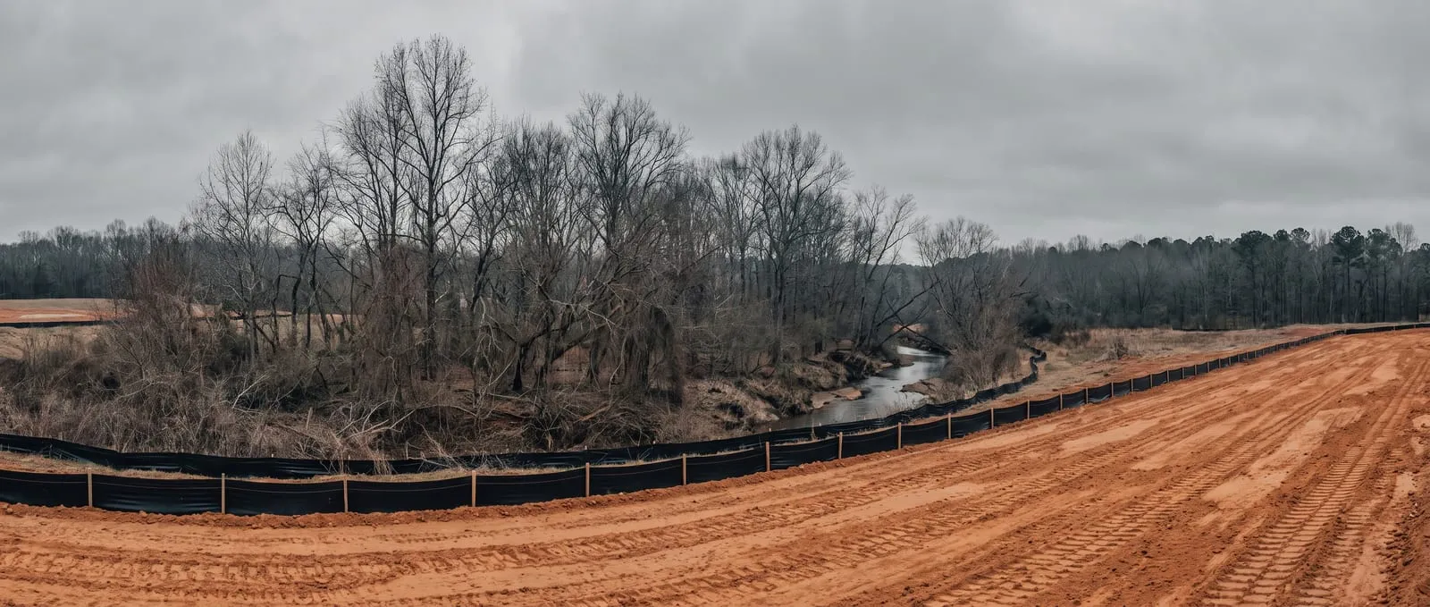
The two questions people land on this page for
Do I need a grading permit in Guilford County?
Two separate triggers. The first is size: one acre or more of land disturbance, including non-contiguous work that's part of a larger common plan. The second is location: grading inside Tier 1 or Tier 2 of a Watershed Critical Area requires a permit regardless of how small the job is. And if your lot is in a subdivision — a common plan of development — the permit requirements apply to your lot through the subdivision, whatever your own acreage.
What is a Watershed Critical Area and why does it change my permit?
It's the most sensitive part of a watershed — the land nearest a water supply intake or reservoir, where pollution risk is highest. Guilford has four tiers, set by distance from the reservoir's normal pool elevation. Because the Triad drinks this water, grading inside the inner tiers is regulated on location rather than lot size.
A homeowner outside Greensboro plans to regrade a sloping half-acre back yard. The statewide rule requires an erosion plan at one acre, and Guilford’s own grading threshold is the same one acre — so the project looks exempt.
Then the county asks which Watershed Critical Area tier the lot sits in. It’s Tier 2, inside the Randleman Lake water supply watershed, and that changes the answer: inside Tier 1 or Tier 2, a grading permit is required regardless of size. The half acre isn’t the deciding fact. The reservoir downstream is.
That’s the shape of Guilford County permitting, and it’s genuinely different from the rest of the state. This page translates it — the two triggers, the watershed buffers, the surety and the penalties, the process, and every county resource worth bookmarking.
Do you need a permit? Two triggers, not one
Guilford’s grading permit has a size trigger and a location trigger, and either one alone is enough.
Most NC counties key off acreage. Guilford adds geography, because much of it drains to drinking-water reservoirs:
| What sets off a grading permit | Trigger | What it means |
|---|---|---|
| 1 acre or more of land disturbance | The size trigger | Includes non-contiguous work in a larger common plan or tract |
| Inside Tier 1 or Tier 2 of a Watershed Critical Area | The location trigger — size is irrelevant | Also a permanent runoff control structure inside the WCA |
| Your lot is in a subdivision | Common plan of development | Plan, permit, and NCG01 coverage apply through the subdivision, whatever your own acreage |
1 acre or more of land disturbance
- Trigger
- The size trigger
- What it means
- Includes non-contiguous work in a larger common plan or tract
Inside Tier 1 or Tier 2 of a Watershed Critical Area
- Trigger
- The location trigger — size is irrelevant
- What it means
- Also a permanent runoff control structure inside the WCA
Your lot is in a subdivision
- Trigger
- Common plan of development
- What it means
- Plan, permit, and NCG01 coverage apply through the subdivision, whatever your own acreage
A covers the land closest to a water supply intake or reservoir. Guilford maps four tiers, and which one you’re in is set by distance from the reservoir’s normal pool elevation. The inner two carry the permit requirement on their own.
Two more triggers worth knowing:
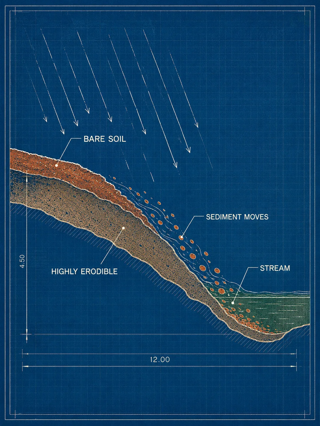
- Highly erodible soil. An erosion and sedimentation control plan is required for work on soils with a k factor greater than 0.36 inside a Watershed Critical Area — a soil-science trigger most homeowners have never heard of.
- Ponds and retention structures inside a WCA require a plan regardless of other factors.
Below an acre and outside a WCA, you may not need the permit — but you are still expected to use erosion control: a residential construction entrance and silt fence, keeping sediment out of streams, buffers, neighbouring lots, and the road.

The Randleman Lake rules and riparian buffers
Randleman Lake is a Class-IV critical water supply watershed, and its riparian buffers are protected no-build zones measured from the water itself.
The 2020 Randleman Water Supply Watershed Rules (15A NCAC 02B .0610 and related sections) replaced the older standards and are what Guilford enforces today, through its Watershed Protection and Stormwater Management Section. If your property touches a stream, pond, lake, or the reservoir inside this watershed, the buffer rules likely reach you.
How the buffer is measured:
- Zone 1 begins at the normal water level and runs 30 feet landward, measured horizontally.
- Zone 2 is a stable vegetated strip beyond it. Zones 1 and 2 together are 50 feet on all sides of the surface water.
- New development using the high-density option carries a 100-foot vegetated buffer along perennial streams.
Three practical consequences:
- You need Buffer Use Authorization from the county before any construction begins inside a streamside zone. It isn’t automatic.
- The Table of Uses governs what’s allowed — activities are Exempt, Allowable, or Allowable with Mitigation. Anything not listed is prohibited and requires a variance. It lives in the Guilford County Unified Development Ordinance, Chapter 15, Article II, Subsection 9.
- Runoff must enter the buffer as diffuse flow. Concentrated flow has to be dispersed and vegetation re-established; new stormwater conveyances generally can’t run through a buffer.
Buffers apply to perennial and intermittent streams, lakes, reservoirs, and ponds that meet the mapping criteria — appearing on USGS topographic maps or Soil Survey maps. Assuming your small creek doesn’t count is a common and expensive mistake.

What the permit process looks like
Plans are submitted 30 days before work begins, and no building permit issues until the erosion control chain is complete. The sequence:
- Determine both triggers — your disturbance area, and your Watershed Critical Area tier. The county’s Erosion Control staff (336-641-3803) can confirm the tier.
- Have the plan prepared and sealed by a registered professional engineer, architect, landscape architect, or registered surveyor.
- Submit 30 days before land-disturbing activity starts, with the erosion and sediment control plan checklist items, Guilford County general plan notes, self-inspection guidelines per 113A-54.1, and seeding specifications.
- File the paperwork — grading permit application with a financial responsibility statement (original wet-signed and notarized hardcopy mailed to Guilford County Planning and Development, Soil Erosion Section), a current deed, and the landowner’s written consent if the financially responsible party isn’t the owner.
- Post erosion control surety — $1,500 per acre disturbed, to the nearest tenth of an acre, may be required above one acre.
- Add state coverage — coverage where it applies.
- Pass the certificate of erosion control performance — confirming initial devices are installed and working. No building permit issues before this.
- Establish ground cover on schedule — in High Quality Water zones, within 15 working days or 30 calendar days of completion, whichever is shorter.
The penalty is not nominal. Grading without a required permit can draw civil penalties around $500 per day, plus stop-work orders and a hold on the certificate of occupancy.
Every Guilford resource you’ll need
If you’re hiring, start with hiring a grading contractor in Greensboro — the watershed-tier question is the sharpest vetting filter available to you.
Grouped by what you’re trying to do.
Before you dig
- NC 811 — call before you dig. Free and legally required: notify utility owners at least two business days before breaking ground. Call 811 or 1-800-632-4949.
- Confirm your Watershed Critical Area tier. This is the Guilford-specific step, and it determines whether size even matters for your project. Erosion Control: 336-641-3803.
Before you hire
- NCLBGC license lookup. Any contractor on a project of $40,000 or more must hold an active license. Search at the license portal — no account needed.
- Our verified Triad directory. Every contractor in our Greensboro-area directory is cross-checked against that NCLBGC record before listing.
Applying and tracking
- Guilford County Soil Erosion Control — grading permits, plan review, inspections: Soil Erosion Control. Erosion Control staff: 336-641-3803.
- Watershed Protection and Stormwater Management — Randleman rules, buffers, Buffer Use Authorization: Watershed Protection.
- City of Greensboro Development Services — inside city limits, the city’s Land Development Ordinance also applies.
Site conditions
- USDA Web Soil Survey. Pull soil ratings for your parcel at Web Soil Survey — relevant here beyond the usual, since the k factor can itself trigger a plan inside a WCA.
- Red clay, explained. Our Piedmont red clay guide and the NC clay French drain methodology cover why the soil drives every drainage decision in the Triad.
Which office covers you
Guilford County’s Soil Erosion Section administers the grading program, and the City of Greensboro layers its own Land Development Ordinance on top inside city limits. High Point and the county’s smaller towns each have their own development rules, and Winston-Salem is a different county entirely (Forsyth).
The practical rule: confirm your address with the county first, since the Watershed Critical Area tier is county-mapped and applies regardless of which municipality you’re in. Then check whether a city ordinance adds requirements on top.
What this means for your project
Guilford rewards asking one question most homeowners never think to ask: not “how big is my project?” but “whose drinking water is downhill from me?” The size trigger is ordinary. The watershed trigger is the one that catches people, and it doesn’t care that your job is small.
For the wider Triad picture — red clay, the reservoir watersheds, and how the region’s earthwork fits together — start at the Triad earthwork hub. And if you’re vetting a contractor for a Guilford job, the Greensboro directory lists only operators whose licenses we’ve checked against the public record.
We’re a directory, not a permit office — we can’t file, expedite, or influence anything. What this page can do is get you to the right counter with the right questions already answered.
Verified contractors in Guilford County
Every licence number below links to that contractor’s own record on the NC Licensing Board — we don’t ask you to take our word for it.
From our directory
Verified contractors across Guilford County
Every listing is cross-checked against the NC Licensing Board public record before it appears. Pick your city:
Or browse the full NC contractor directory.