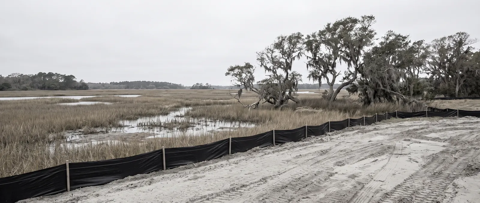
Every other region in North Carolina asks the same question about grading: how big is the job?
The coast asks a different one: how close are you to the water?
That’s because coastal North Carolina is the only part of the state with a second permit system layered on top of the usual rules. The governs development inside designated Areas of Environmental Concern, and its triggers are measured in feet from the water’s edge. A project too small to need anything anywhere else in the state can need a state permit here.
The soil is inverted too. Inland North Carolina fights dense red clay that refuses to drain. The coast has sand that drains almost too well — until you hit the water table a few feet down, and the whole calculation changes.
This page is the map. Below: what coastal soil actually does, how the two permit systems stack, and every coastal guide we’ve published.
What’s actually different on the coast
Two things, and neither one applies anywhere else in North Carolina.
There’s a second permit system. CAMA is a state law administered by the Division of Coastal Management. It sits alongside — not instead of — your county or city land-disturbance permit. Most coastal homeowners have never heard of it until a project stalls.
“Development” is defined far more broadly than you’d expect. Inside an Area of Environmental Concern, CAMA’s definition covers excavation, filling, removing sand, driving pilings, clearing land as an adjunct of construction, and altering sand dunes. Moving sand around your own lot can be regulated activity.
The soil is sand over groundwater, not clay. Percolation isn’t the problem here; the water table is. A drainage design that works in Piedmont clay is solving the wrong problem on the coast, and vice versa.
Impervious surface is watched closely. Coastal counties operate under stricter stormwater rules than the rest of the state. Driveways, patios, and additions accumulate toward thresholds that trigger a stormwater permit well before you’d expect.
The two permit systems, side by side
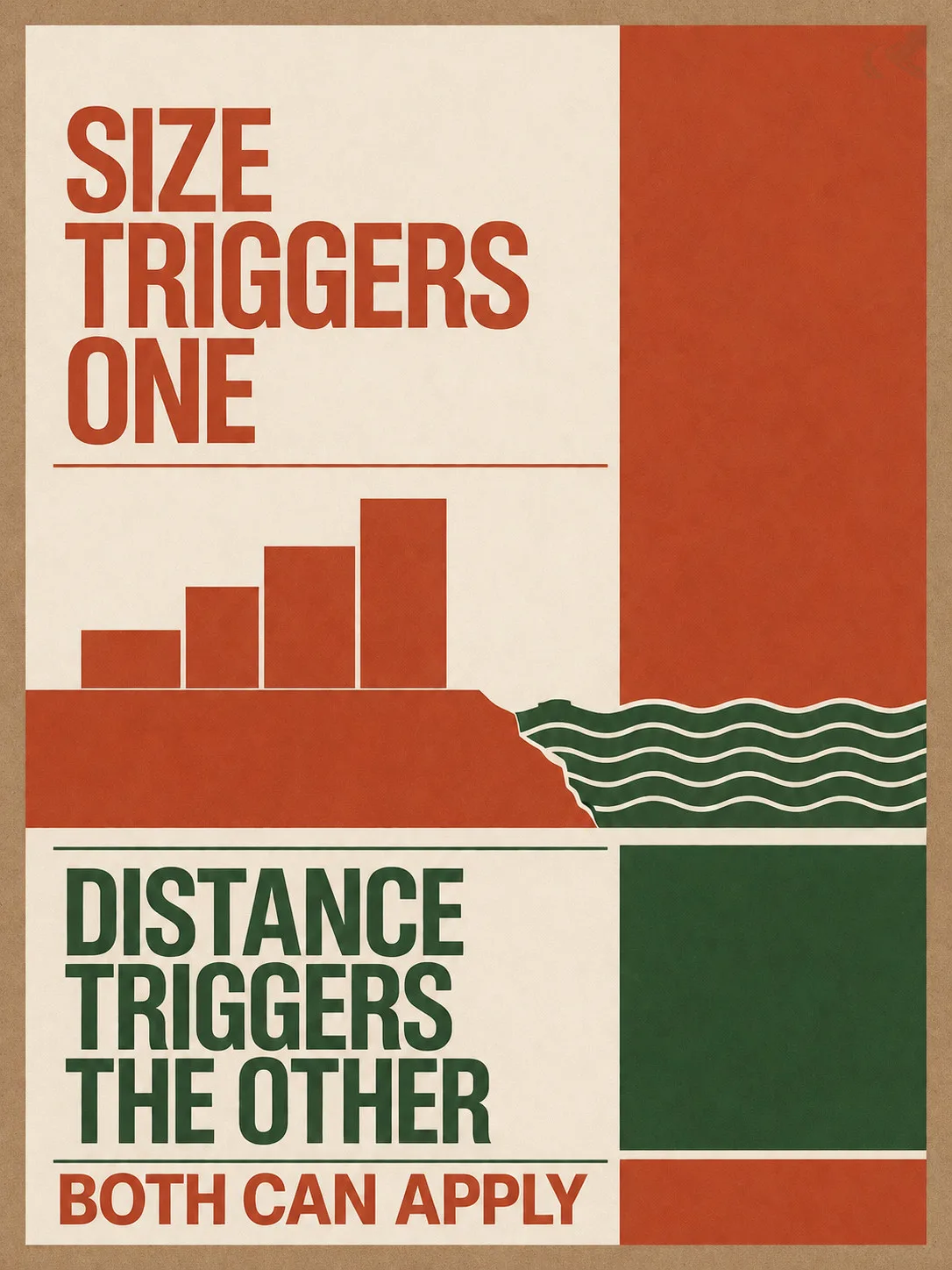
One is about size. The other is about distance from water. You can trigger either, both, or neither.
| The two systems | What triggers it | Who administers it |
|---|---|---|
| Land-disturbance permit | One acre or more of disturbance, or part of a larger common plan of development | Your county or city -- the statewide erosion rule |
| CAMA permit (coastal only) | Development inside an Area of Environmental Concern -- set by distance from water, not project size | NC Division of Coastal Management; minor permits are issued locally under contract with the state |
| Stormwater permit | New impervious surface above the county threshold, or disturbance under the coastal stormwater rules | Your county or city, under NC coastal stormwater regulations |
| Flood-zone requirements | Building in a mapped FEMA flood zone -- elevation requirements apply | Your local floodplain administrator |
Land-disturbance permit
- What triggers it
- One acre or more of disturbance, or part of a larger common plan of development
- Who administers it
- Your county or city -- the statewide erosion rule
CAMA permit (coastal only)
- What triggers it
- Development inside an Area of Environmental Concern -- set by distance from water, not project size
- Who administers it
- NC Division of Coastal Management; minor permits are issued locally under contract with the state
Stormwater permit
- What triggers it
- New impervious surface above the county threshold, or disturbance under the coastal stormwater rules
- Who administers it
- Your county or city, under NC coastal stormwater regulations
Flood-zone requirements
- What triggers it
- Building in a mapped FEMA flood zone -- elevation requirements apply
- Who administers it
- Your local floodplain administrator
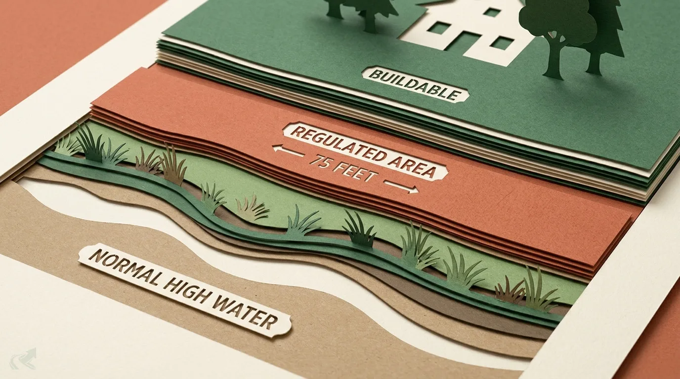
An is a designated zone where CAMA applies. The boundaries are set by distance from particular water features — the estuarine shoreline AEC, for example, extends 75 feet landward of normal high water. Other AECs are drawn around ocean beaches, dunes, inlets, and Outstanding Resource Waters, each with its own distance.
Two things make this catch people out. First, the distances differ by water type — the number that applies to your neighbour’s creek-front lot may not be the number that applies to yours. Second, CAMA minor permits for single-family homes are issued by local governments under contract with the state, so the office you visit is local even though the permit is a state one.
Precise AEC distances, thresholds, and contacts are on the New Hanover County page. For any other NC county, use the permit lookup tool. If your lot touches or is near water of any kind, ask about CAMA before you break ground — it’s the question homeowners here don’t know to ask.
Sand, the water table, and why drainage is different
Inland, water can’t get into the ground. Here, it can’t get away from it.
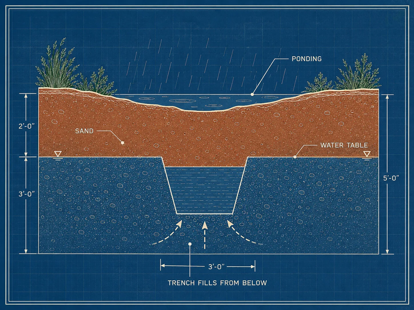
Coastal soils drain fast. That sounds like it should end drainage problems, and often it does — right up until the point where the water table sits close to the surface. After sustained rain, groundwater rises, the sand saturates from below, and surface water has nowhere left to go. The yard floods in soil that a soil test would call excellent.
This inverts a lot of standard advice. Digging deeper is the reflexive fix for a drain that isn’t working; on the coast, digging deeper can put your trench into the water table and leave you with a pipe that fills with groundwater and stays full. The useful question is where the water is going to go, not how far down you can dig.
The other coastal factor is salt and storm exposure. Material choices that last inland corrode faster near salt air, and grading that ignores storm surge or a mapped flood elevation creates problems that only show up in the worst weather.
Our general drainage guides cover the methods; the standing water guide covers diagnosis. Read both with the water table in mind rather than clay.
Every coastal guide, by problem
Start with the problem you actually have.
- Water sits in my yard after rain — Standing water, diagnosed · Drainage methods
- I need to know which permits apply — New Hanover County · statewide permit lookup
- My lot is near water, marsh, or the beach — CAMA and the AEC rules
- I’m planning a driveway or a pad — Driveways · Erosion control
- I need fill, stone, or haul-off — Hauling and materials
- How do I check a contractor is licensed? — NC licensing, explained
- I need a contractor now — Verified Wilmington contractors
For the statewide fundamentals — how grading, drainage, and hauling work regardless of region — start at drainage, driveways, or hauling.
Cities and counties we cover
Our coastal coverage centres on New Hanover County — Wilmington, Wrightsville Beach, Carolina Beach, Kure Beach — and extends into Brunswick (Leland, Southport, Oak Island), Pender (Hampstead, Surf City), and Onslow (Jacksonville, Sneads Ferry).
All of these sit within North Carolina’s 20 CAMA-regulated coastal counties, so the second-permit-system rule applies across the region. What varies is the local threshold detail and which office administers it. If you’re outside New Hanover, the soil and drainage guidance here still holds — confirm permit thresholds and your AEC status with your own county. The NC permit lookup covers all 100 counties.
From our directory
Verified coastal contractors by city
Every listing is cross-checked against the NC Licensing Board public record before it appears. Pick your city:
Or browse the full NC contractor directory.