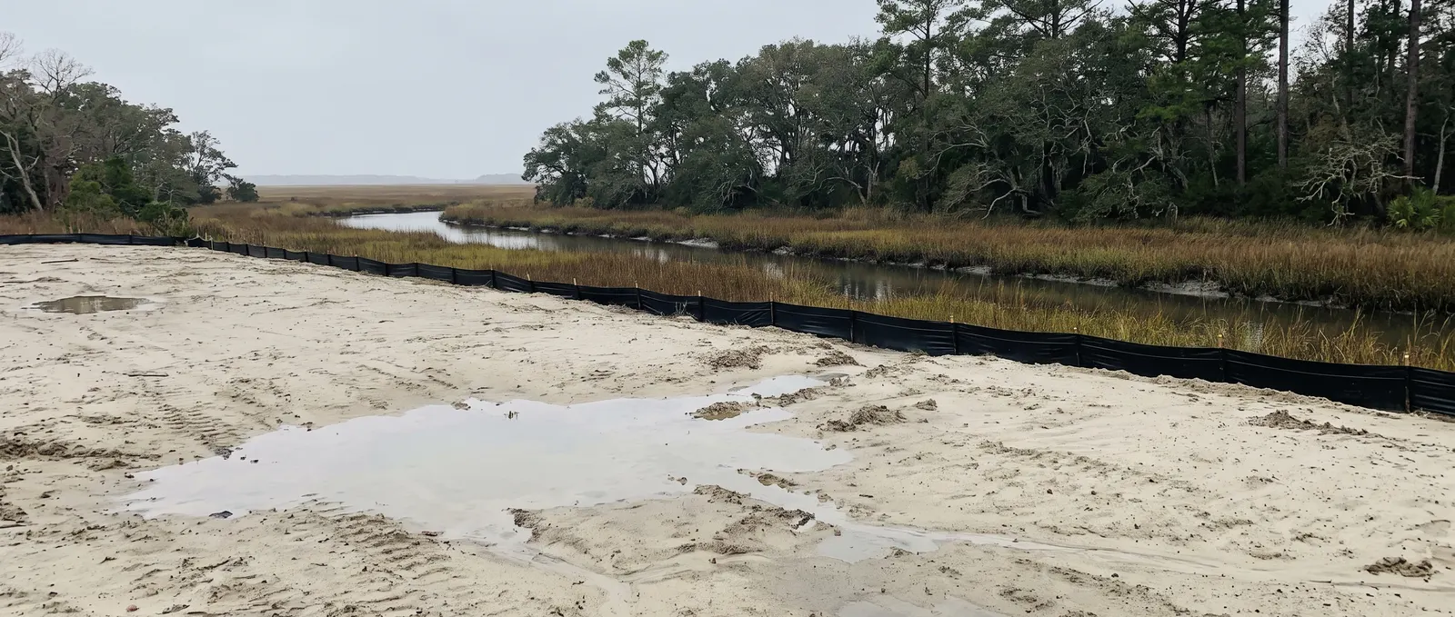
What New Hanover homeowners ask first
When does New Hanover County require a land disturbance permit?
At one acre or more of land-disturbing activity. It also applies below an acre if a permit was already issued on the property, or if your parcel is part of a larger common plan of development — a subdivision, for example. But that's only the first of three systems: CAMA can apply to a much smaller job near water, and stormwater kicks in at 10,000 square feet of new impervious surface.
Which office reviews erosion control plans in Wilmington?
New Hanover County Engineering reviews sediment and erosion control plans for both the unincorporated county and the City of Wilmington — one office covering both. That's unusual and it simplifies things: city-limits homeowners don't need a separate city erosion review. CAMA minor permits are handled locally too, under contract with the state.
Most North Carolina counties give you one permit question to answer. New Hanover gives you three, and they’re triggered by three completely different things.
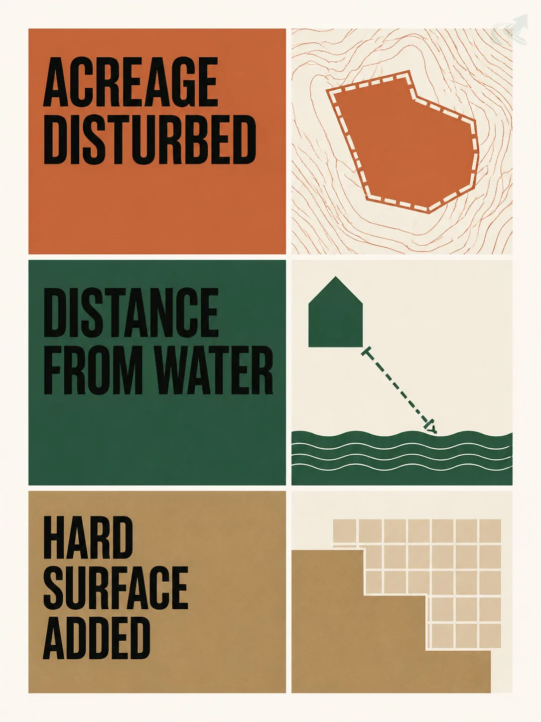
Acreage triggers the land-disturbance permit. Distance from water triggers CAMA. Square footage of hard surface triggers stormwater. A project can clear the first two and still need the third — and the one that catches people out most often is CAMA, because it’s a state permit system that only exists in the twenty coastal counties, and its trigger has nothing to do with how big your project is.
This page covers all three, plus the flood-elevation layer, and who to call for each.
Three permit systems, three different triggers
Answer all three questions, not just the first one.
| What sets off each requirement | The trigger | What to know |
|---|---|---|
| Land disturbance permit | One acre or more of land-disturbing activity | Also applies below an acre if a permit was previously issued on the property, or the parcel is part of a larger common plan of development |
| CAMA permit | Development inside an Area of Environmental Concern -- measured in feet from water, not project size | Estuarine shoreline AEC runs 75 feet landward of normal high water; other AECs use their own distances |
| Stormwater permit | 10,000 square feet or more of new impervious surface, on a site or as part of a common plan | A one-time 3,000 sq ft exemption may apply where existing built-upon area already exceeds -- or will exceed -- 10,000 sq ft |
| Coastal stormwater runoff control | Disturbing 10,000 sq ft or more of land | Must control runoff from the first 1.5 inches of rainfall, under the state coastal stormwater rules |
Land disturbance permit
- The trigger
- One acre or more of land-disturbing activity
- What to know
- Also applies below an acre if a permit was previously issued on the property, or the parcel is part of a larger common plan of development
CAMA permit
- The trigger
- Development inside an Area of Environmental Concern -- measured in feet from water, not project size
- What to know
- Estuarine shoreline AEC runs 75 feet landward of normal high water; other AECs use their own distances
Stormwater permit
- The trigger
- 10,000 square feet or more of new impervious surface, on a site or as part of a common plan
- What to know
- A one-time 3,000 sq ft exemption may apply where existing built-upon area already exceeds -- or will exceed -- 10,000 sq ft
Coastal stormwater runoff control
- The trigger
- Disturbing 10,000 sq ft or more of land
- What to know
- Must control runoff from the first 1.5 inches of rainfall, under the state coastal stormwater rules
The two 10,000-square-foot numbers are easy to confuse. One is about impervious surface created (driveway, patio, roof, slab). The other is about land disturbed (anything you grade, strip, or excavate). They’re separate tests and a project can trip one without the other.
Note also that impervious surface accumulates. A driveway extension that’s fine on its own can push a lot over the threshold when added to what’s already there — which is exactly what the one-time 3,000 square foot exemption exists to soften.
CAMA: the permit system that only exists on the coast
A state permit triggered by how close you are to the water.
The Coastal Area Management Act requires a permit for “development” inside a designated Area of Environmental Concern. Two parts of that sentence do all the work.
“Development” is broad. The statutory definition covers construction or enlargement of a structure, excavation, dredging, filling, dumping, removal of clay, silt, sand, gravel or minerals, bulkheading, driving of pilings, clearing or alteration of land as an adjunct of construction, alteration or removal of sand dunes, and alteration of the shore, bank or bottom of any sound, bay, river, creek, stream, lake or canal. Several of those are things a homeowner would describe as “just moving some dirt.”
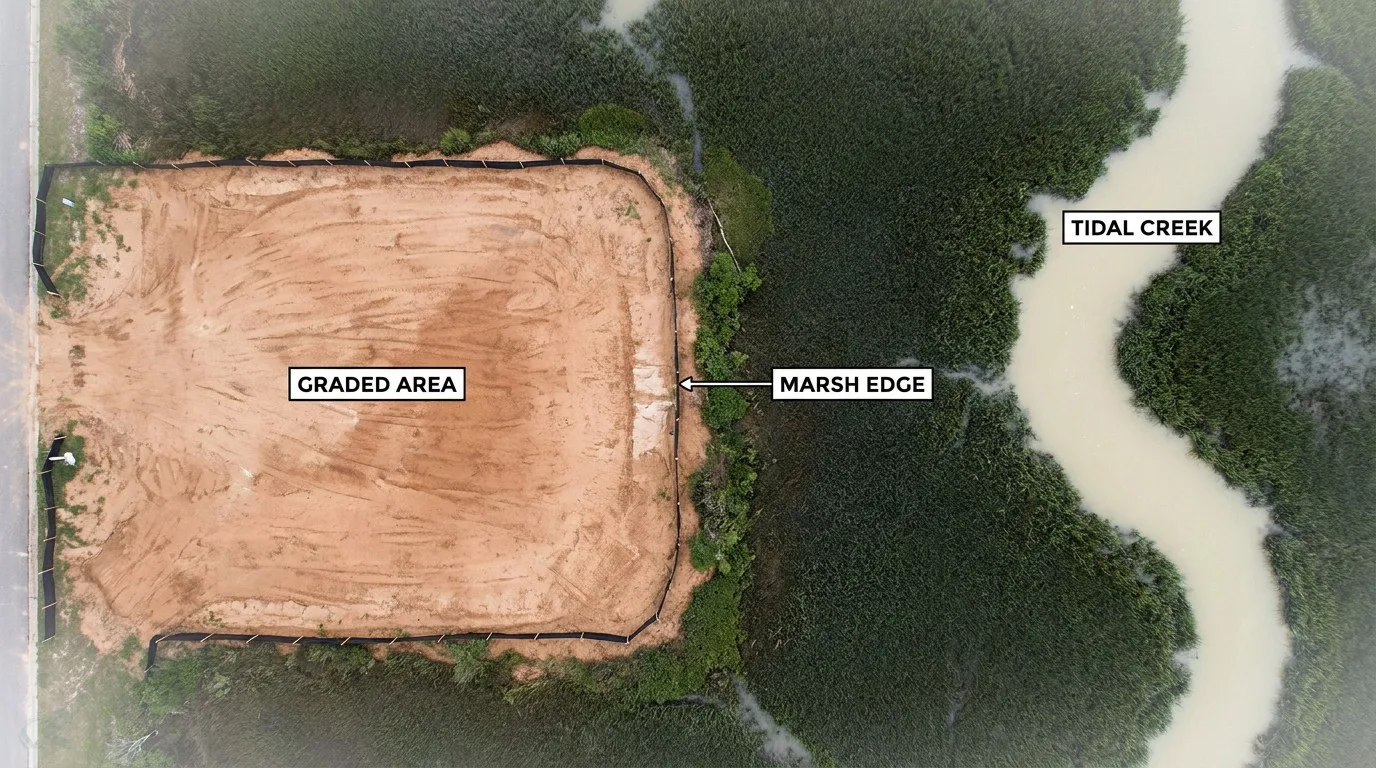
AECs are drawn by distance from water. The estuarine shoreline AEC extends 75 feet landward of normal high water or normal water level. Other AECs are drawn around ocean beaches, frontal dunes, inlets, and Outstanding Resource Waters, each with its own distance. Which one applies depends on what body of water you’re near — not on your lot size.
The category that covers a typical single-family project is the CAMA minor permit. These are reviewed, issued, and administered by local governments under contract with the Division of Coastal Management, to Coastal Resources Commission standards. So although CAMA is a state law, the office you deal with is local. That’s convenient, but it’s also why many homeowners assume it’s just another county permit and underestimate what it governs.
If your property touches or is near a creek, sound, marsh, river, canal, or the ocean, ask the local CAMA officer whether an AEC covers your lot before you plan the work. It’s the single most common coastal surprise.
Stormwater and impervious surface
Two thresholds, both at 10,000 square feet, measuring different things.
New Hanover’s stormwater ordinance requires a stormwater permit and management plan for development or redevelopment creating 10,000 square feet or more of new impervious surface, whether on a single site or as part of a common plan of development. A one-time exemption may be granted for adding 3,000 square feet of built-upon area where the existing built-upon area already exceeds 10,000 square feet, or will with the addition.
Separately, because New Hanover is one of North Carolina’s twenty coastal counties, the state coastal stormwater regulations apply. Under those rules, development disturbing 10,000 square feet or more of land must control the runoff from the first inch and a half of rainfall. That’s a stricter standard than inland North Carolina, and it exists because coastal waters — shellfish beds, nursery areas, Outstanding Resource Waters — are more sensitive to what runs off into them.
For a homeowner, the practical read is: hard surface counts, it accumulates, and on the coast the runoff standard is higher than the one your friends inland are working to.

Flood elevation, sand, and the water table
The physical constraints that shape coastal earthwork.
Much of New Hanover sits in or near mapped FEMA flood zones, and building in one brings elevation requirements administered by the local floodplain administrator. Grading interacts with this directly: fill, pad height, and how water moves across a lot all matter when a base flood elevation is in play. Confirm your flood zone before designing anything that changes site levels.
The soil story is the inverse of inland North Carolina. Coastal sand percolates well, so drainage failures here usually aren’t about slow soil — they’re about the water table. When groundwater sits a few feet down and rises after sustained rain, the sand saturates from below and surface water has nowhere to go. A trench dug deeper in search of drainage can end up sitting in groundwater and staying full.
Salt air is the third factor. Materials that last inland corrode faster near the coast, which affects the choice of pipe, fasteners, and any metal structure in a drainage system.
Our standing water guide covers diagnosis, and the drainage hub covers method — read both with the water table, rather than clay, as the constraint.
Every New Hanover resource you’ll need
- Do I need a permit? — the three-trigger table above, then the statewide permit lookup
- My yard holds water — Standing water, diagnosed · Drainage methods
- I’m planning a driveway or pad — Driveways · Erosion control
- I need fill, stone, or haul-off — Hauling and materials
- How do I check a licence? — NC licensing, explained
- The work was done badly — When the work is done wrong
- Regional context — Earthwork on the NC coast
- I need a contractor — Verified Wilmington contractors
Which office covers you
New Hanover County Engineering reviews sediment and erosion control plans for the unincorporated county and the City of Wilmington — one office for both, which is simpler than the split arrangements found in many NC counties. Failure to obtain a required land-disturbing permit can carry penalties of up to $5,000 per day, and criminal penalties are available in addition.
CAMA minor permits are handled by the local permit officer under contract with the Division of Coastal Management. Flood-zone questions go to the local floodplain administrator. If you’re in Wrightsville Beach, Carolina Beach, or Kure Beach, confirm which of these functions your town administers directly — beach towns often run their own CAMA and floodplain desks.
What this means for your project
If you’re doing a small back-yard regrade well away from water, on a lot with modest hard surface, you’re likely outside all three systems — but confirm rather than assume.
If your lot touches water of any kind, CAMA is the first call, not the last. It’s the system most likely to apply to a project that looks too small to be regulated, and the one whose definition of “development” is broadest.
And if you’re adding hard surface, add it up across the whole property rather than just the new piece. The thresholds count what’s there, not what you’re adding.
Verified contractors in New Hanover County
Every licence number below links to that contractor’s own record on the NC Licensing Board — we don’t ask you to take our word for it.
From our directory
Verified contractors across coastal NC
Every listing is cross-checked against the NC Licensing Board public record before it appears. Pick your city:
Or browse the full NC contractor directory.